1 Chapter 1. Are we there yet?
Learning Objectives
At the end of this chapter, the student will
- understand the importance of analyzing maps – topographic, vegetation, climatic, and geologic – of the study area
- be aware of all the other logistical aspects of a field trip: clothing, food, tools, water and medication
1.1.Introduction
Every real field trip experience comes with a little bit of anxiety: Are we there yet? Can we start? What do we need to do? There are so many questions, so many new things for you to absorb, so many aspects that need to be considered, that you might feel somewhat overwhelmed. One thing that you can do to soothe that anxiety of the unknown is to do some leg work before the field trip. At minimum, some maps should be consulted for every piece of information that could help in the field, such as: location, relief, rivers or swamps, vegetation and possible dangers. Depending on the purpose of the field trip, a few geological specific tools will be required as well: GPS, altimeter, magnetic compass, shovel, trowel, brush, ruler, Jacob's staff, Munsell Chart, hydrochloridic acid, notebook, pencil, hand lens, hammer, and sample bags. And on top of that, some personal equipment: sweater, sun screen, mosquito spray, a pair of socks, first aid kit, and a lot of water. A virtual field-trip should be no different, even if you’re doing it from the comfort of your favourite chair. Might be a good practice to learn how to pack all that equipment in a way that allows for ease of use and it is as compact as possible. Imagine that you packed everything so that you can have access at all tools at all times but the backpack is the size of a bus. Impossible to use in the field!
Consequently, let’s have a look at all the pre-field trip aspects that could help us analyze and interpret a new area.
1.2. Pre-field study guide
Reading, even a little bit, about the study area goes a long way when you’re out in the field. For one, it gives you a baseline of information on what to expect, which in turn raises your level of confidence and it allows you more time to study aspects that are still unclear. Part of this pre-field exercise includes the maps and the information provided by them: location, relief, vegetation, climate, rock types and possible dangers. Basically, all the information that can be provided by a map will prove useful while in the field. Ready to have a look at the information provided by the maps and their usefulness?
1.2.1. Location, location, location
Remember those Real Estate TV shows? Most of them mention that one of the most important feature of a house is… You’ve guessed right, location!
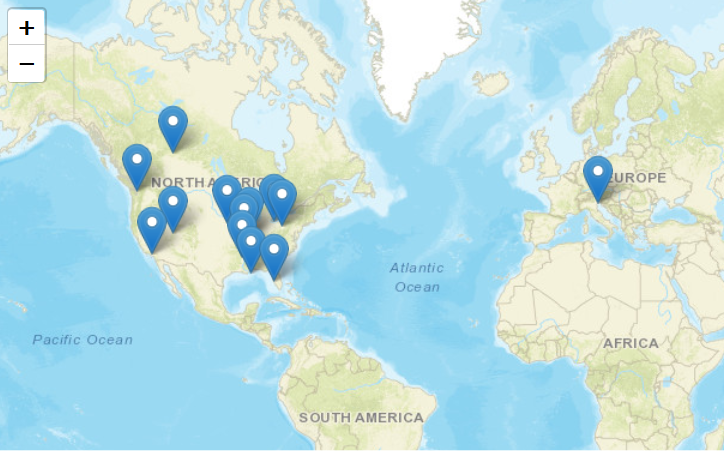
Why is the location important? Well, for the sake of the exercise let’s imagine that we suggest to have a field trip to Venice, but we’re not going to mention exactly where this town of Venice is located. You’ll probably assume that we’re talking about the most famous place called Venice in Italy, and you’ll pack accordingly. But, did you know that there are 13 places in the world that are called Venice? All these locations are shown in figure 1.1. So, how would you know to each one of them we’ll take you to? (Our plan is to have a field trip to Venice, Alberta.) Can you imagine the situation you’ll be in, when getting to Venice-our destination- you’re ready for a hot summer field trip but you are in an area that is cold and full of mosquitoes and black flies? Consequently, take our advice and check a map (Google will do fine as well – if you have power or signal) to see where the area is located, as precisely as possible.
1.2.2. Mountain high or valley deep?
Now, that you are sure of the location of the study area, the second step will be to get an idea about how the local relief looks like. You may ask why. The short answer will be something like this: “Because it will make it easier to plan for the path to take in the area”. Would you like to jump off some cliffs when there is an easier path to take in the vicinity? If you do, remember that in a geological field trip, you have to carry a lot of gear. Consequently, it might be just better to take the easier path. Assessing the relief of an area can be done using a few different tools, such as topographic maps, relief maps or satellite views on Google Earth or aerial photos.
If you use a topographic map, look how far spaced the contour lines are. Remember that the closer the lines, the steeper the relief. Consequently, it might be wise, if you can, to plan your itinerary on a different area of the map. If you can’t avoid the steep slopes, no matter the reason, be prepared to climb ridges and cross swamps. They tend to go together! Your extra dry pair of socks in your backpack might be handy after all!
If you use a relief map, look for the colours. Remember that green is usually used for plains or relatively flat low relief, while shades of brown to white are used for higher topography. Different shades of blue are used for water bodies. Do not forget to check the scale of the map! A tiny blue stream can turn out to be a wide river that can’t be crossed! Dead-end!
Both the satellite view on Google Earth and the aerial photos are going to show the relief, the bodies of water, but also the presence or absence of vegetation. One incredible advantage of our digital era is that by using the satellite view you can zoom in as much as you can to get a really good idea about the study area.
1.2.3. To be or not to be vegetated?
Determining the precise location and the local relief of the study area is very important during the pre-field trip preparation. If you have access to vegetation maps or satellite view, understanding the type of vegetation can prepare you for some inconveniences. It is not the same if you have to trek through rabbit bush or in the grasslands, if you have to cross a swamp or a deciduous forest. Plus, you can also assess if you’ll need sunscreen or mosquito spray or both!
1.2.4. Feels like summer…
We all know that long term forecasts are not really reliable. And yet, we need to plan in advance for our field trip. One thing to take in consideration is the time of the year. Depending on where you are and where the field trip is going to be, the first consideration should be given to the time of the year. Generally speaking, geologists like to do field work during the summer. Unless you need to do your fieldwork in the Arctic or somewhere else cold. In the summer, the weather is more forgiving and it is definitely more pleasant to work when the temperature are positives than when they are below 0. Not talking about the fact that it is easier to see the rocks when they are not under the snow cover.
One thing that you can do before going out in the field is to study a climograph to get an idea about the average temperatures and precipitations over a historic period of time, and generally you should look at the last 30 years. But at the end of the day, just hope that the weather will be nice enough for you to bring along the sunscreen and the hat.
1.2.5. Rock out
If you have access to a geological map of the area, have a look at the rock formations paying attention to their type, structures and ages.
One thing to keep in mind is that all these elements mentioned above, topography, vegetation, relief, climate and rock types, are deeply interconnected. The type of rock will dictate the topography and the relief aspects; the types of rocks and the climate will have an impact on the vegetation; the climate will affect the topography and relief through types of weathering and erosion processes. You can’t just look at one isolated aspect. In order to really understand what happens in an area you have to take a good look at all those aspects.
Key Takeaways
Reading up, even a little bit, about the area where you’re going for the field trip it is going to pay off in long run. Even glancing briefly over a map will provide you with information regarding:
- Precise location.
- Relief of the area.
- Climate.
- Presence or absence of vegetation. Depending on the map type, even the type of vegetation can be inferred.
- Rock type.
- All the elements presented above are interconnected. The final aspect of the area is the result of all those elements working together.
1.3. Geological tools to pack
After reading about the area and looking at the maps, it starts the second phase of preparations: what tools shall you pack? Obviously, in the field you have to be prepared with the necessary tools otherwise there is no way to get them and your observations will be incomplete. Imagine that in the middle of a 8 km traverse through thick bush and wet swamps you realised that you did not pack something that you need! There is no way to go back! Your observations will be based on alternate methods and in some cases, that might be just enough. But if you need precision, than make sure the necessary tools are packed and easily accessible. At the same time you have to be very realistic about your packing. Let’s assume you packed any tool that you could think of. How heavy your backpack is going to be? So heavy that you won’t be even able to lift it, not mentioning that you have to carry it along the traverse.
Consequently, when you pack your tools for the field think about the rock type that you’ll encounter, the purpose of the field trip and the distances that you’ll have to carry those tools. For any geological field trip some, if not all, of the following tools will be required: GPS, altimeter, magnetic compass, shovel, trowel, brush, ruler, measuring tape, Jacob's staff, Munsell Chart, hydrochloridic acid, notebook, pencil, hand lens, hammer, and sample bags.
As a good rule of thumb, a good start in packing will include the following tools, used not only to analyzed the rocks encountered but also to help you find your way back: magnetic compass, HCl, notebook, pencil, hammer, hand lens and sample bags. After that, there are decisions to be made. Do you need that sledge hammer for soft rocks? Probably not, but you might need a shovel. Do you need the GPS and the magnetic compass? Definitely! If you have to walk for 8 km through thick bush and swamp, would you carry the Jacob's staff with you? Probably not! In that case a tape measure will do! But if you have to walk only a half km on grasslands and you have three other teammates, you’ll probably carry the Jacob's staff, the metallic ruler, the shovel, and any other tool that you think you might need. So, before you get too enthusiastic and determined to pack all the tools available, think about all the factors at play and make some strategic decisions about packing. It will be worthy! In what it regards the field trip to the Avonlea Badlands, we’re going to talk about specific tools to pack a little bit later.
Key Takeaways
The geological tools that you need to pack in a field trip depend on few factors:
- The rock type to be analyzed
- The purpose of the field trip
- The distances that you have to carry all those tools
1.4. The new clothes of the emperor
Last but not list, we should talk briefly about what else you should pack or what clothes to wear. For some of you this might be the first geological field trip. And sometimes it is hard to admit that you do not know what to pack.
Well, let’s start with the beginning. The clothes for the field trip. You’re young and it is very tempting to bring along your brand new brand-name clothes. And it is your right to do so. But if you look at the geologists that have done this for a long time, barely ever you’ll see them in new brand-name clothes. Why is that? Because the geologists know that during a field trip anything can happen. The clothes can be torn apart by the vegetation and by the rocks; crossing a swamp will get the clothes muddy beyond recognition. More important than anything is that the clothes are comfortable, allowing for unrestricted movement as much as possible. You’ll also need to wear layers. If the weather is changing for worse, you can always add another layer. A rain jacket might be a good idea and also an extra pair of socks, just in case the one you’re wearing gets wet. It is not very pleasant to work all day in a pair of wet socks! If you want, and if you have them, a pair of gaiters could do wonders, mostly when going through thick vegetation or swamps. Generally waterproof, the gaiters will add another layer of protection to your clothes, keeping them dry below the knees. To this list we should add that a long sleeve shirt and long pants are highly recommended. The shirt and the pants are going to offer the most amount of protection for your skin. Protection from the sun, from the bugs and from the scratches.
The one thing that people disregard to the pain of their feet is the boots. Boots! Not snickers, not sandals, not flip flops! Boots will support your ankles the best during a field trip. But, never take brand new boots in the field! Your feet will thank you! Brand new boots that are not yet broken in are not yet adjusted to your feet causing painful blisters to appear. Consequently, if you have to buy new boots, make sure you buy them a few days in advance and wear them inside the house if you have to.
Now that we talked about clothes and boots, let’s see what else we should consider packing. Are you going out during a hot time of the year? Maybe some sunscreen, if you burn easy, and some sort of hat will be a great idea to have in your backpack. Are there a lot of mosquitoes and/or black flies and you get really bugged by those insects? Bring some mosquito spray along. Are you allergic to anything? Make sure your EpiPen is not expired and bring it along. Do you have asthma or need medication? Remember to bring those items along.
Last but not least, make sure you have lots of water with you. Dehydration is very dangerous and can play mind games on you! And, if you’re the type of person that needs snacks, bring those along too. It is a very good rule of thumb to bring snacks that are compact and have high caloric coefficient for a boost of energy when needed.
Key Takeaways
When planning for a field trip, make sure that:
- Your clothes are comfortable and you are dressed in layers
- Your boots are broken in before the day of the field trip
- Your backpack contains: sunscreen, mosquito spray, any required medication, and lots of water and snacks
We know you are anxious to start this virtual adventure, so let’s move on. Before we start exploring the geological wonders of the Avonlea Badlands, let’s take out the maps – if you still own one, or ask Google where in Saskatchewan are located these badlands.
A map is a symbolic depiction emphasizing relationships between elements of some space, such as objects, regions, or themes. Many maps are static, fixed to paper or some other durable medium, while others are dynamic or interactive.
A trip made by students or research workers to study something at first hand. In geology is one of the most prized experiences.
The difference in height from the surrounding terrain; the amount of variation in elevation and slope in a particular area.
An instrument used to measure the altitude of an object above a fixed level. In most cases, the fixed level is the average sea level which has a value of 0m. The measurement of altitude is called altimetry, which is related to the term bathymetry, the measurement of depth under water.
In surveying, a jacob staff is a single straight rod or staff made of nonferrous material, pointed and metal-clad at the bottom for penetrating the ground. Here, it is used to describe a 2m wooden rod that is painted in alternating strips of white and black to show the following divisions: 1m, 50 cm, and 5 strips of 10 cm each.
The Munsell Color System describes a soil’s color, based on Hue, Value & Chroma. The Munsell Chart is a collection of color chips with varying degrees of hue, value & chroma. Take a small soil sample and match it up with the appropriate color chip to determine that soil’s Munsell “code.”
HUES tell you how red the soil is… 2.5YR (2.5 parts yellow to 1 red) is pretty red; 10YR (10 parts yellow to 1 red) is more yellow…
VALUES tell you how dark the soil is; A horizons are darker, with a lower value (2 or 3) due to humus. E horizons are often light colored (5 or 6 value).
CHROMA tells you how bright vs. dull the soil is; a low chroma (2 or less) means the soil is GREY, hence wet or waterlogged; higher chromas mean better drained, more oxidized soil.
A topographic map is a detailed and accurate illustration of man-made and natural features on the ground such as roads, railways, power transmission lines, contours, elevations, rivers,
lakes and geographical names.
A map indicating hills and valleys by shading rather than by contour lines alone.
An aerial photograph, in broad terms, is any photograph taken from the air. Normally, air photos are taken vertically from an aircraft using a highly-accurate camera.
A line on a map joining points of equal height above or below sea level.
The arrangement of the natural and artificial physical features of an area.
In Saskatchewan, a rabbit bush is a coniferous forest with closely spaced thin trees. The trees did not have room to grow and develop normally and it is so thick that only a rabbit would be able to go through it. It is almost an enchanted forest that pulls on your clothes and backpack and it is very hard to go through. Usually at the edges of swamps.
A large open area of country covered with grass, especially one used for grazing.
A climograph is a graphical representation of a location's basic climate. Climographs display data for two variables: monthly average temperature and monthly average precipitation. These are useful tools to quickly describe a location's climate.
Geologic maps represent the distribution of different types of rock and surficial deposits, as well as locations of geologic structures such as faults and folds. Geologic maps are the primary source of information for various aspects of land-use planning, including the siting of buildings and transportation systems. Such maps help identify ground-water aquifers, aid in locating water-supply wells, and assist in locating potential polluting operations, such as landfills, safely away from the aquifers.
Geologic maps are actually four-dimensional data systems, and it is the fourth dimension of time that is crucial to assessing natural hazards and environmental or socio-economic risk. To read a geologic map is to understand not only where materials and structures are located, but also how and when these features formed.
Weathering is the deterioration of rocks, soils and minerals as well as wood and artificial materials through contact with water, atmospheric gases, and biological organisms.
In earth science, erosion is the action of surface processes that removes soil, rock, or dissolved material from one location on the Earth's crust, and then transports it to another location where it is deposited. Erosion is distinct from weathering which involves no movement.
Badlands are a type of dry terrain where softer sedimentary rocks, such as unconsolidated sands, silts and clays, and clay-rich soils have been extensively eroded. They are characterized by steep slopes, minimal vegetation, lack of a substantial regolith, and high drainage density.
A waterproof garment similar to leggings, worn to cover or protect the ankle and lower leg.
